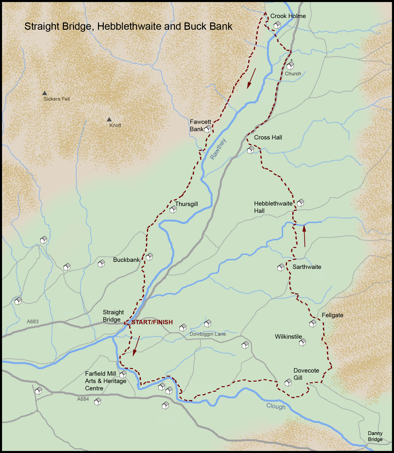
Distance: 6 miles (9.66km), Time: 3 hours, Map: OS Explorer OL19
1. Start from Straight Bridge, one mile east of Sedbergh on the A683. There is a large layby for parking just before the bridge, or follow the riverside path from Sedbergh to make a longer walk.
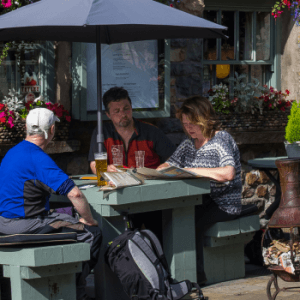
2. Cross Straight Bridge and turn immediately right along a narrow lane to Farfield Bridge. From here you can cross the bridge and turn left to make a short diversion to Farfield Mill Arts & Heritage Centre for a browse around, and coffee or lunch in the cafe. Return to and cross Farfield Bridge to continue your walk.
3. From Farfield Bridge take the riverside path signed Hallbank. Continue walking near the River Clough keeping right after going through a kissing gate, to meet Dowbiggin Lane. Turn right and walk up the gravel track signed Danny Bridge and Hebblethwaite. At a fingerpost on a bend turn left, go through a wicket gate and descend to a footbridge across Great Dovecote Gill. Walk up to the right of a barn and along the path signed Hebblethwaite. Cross a field and a gill and walk along a grassy track to a stile and wicket gate then uphill to pass by the right of a house called Wilkinstile. Continue ahead up to Fellgate, through the gates, turning right then left in front of the house. Go across a field and turn right near a ruined hut, just before New Barn, join the track at the gate and pass the derelict Sarthwaite farmhouse.
4. Continue along the track then turn left to descend across a boggy area towards trees, passing a way marker then crossing the steep sided Hebblethwaite valley. (It’s worth exploring the wood to see its small waterfalls and remains of an old bobbin mill). Turn right at Hebblethwaite Hall then immediately left onto the path signed Cross Hall.
5. At the top of the hill enjoy the dramatic view to the left of Hobdale and Brant Fell. Cross a stile by a tree and descend to a stile and footbridge. Go through the caravan site and Cross Hall Farm to the A683. Turn right and walk alongside the road for 0.6 of a mile. After passing St Mark’s Church turn left down the track to Crook Holme.
6. Cross the River Rawthey via the footbridge and then then ascend to the left up a tree-lined track. Turn left just before a stone ruin, cross a stile, then turn left and walk along the track beside gorse bushes. Follow the track and lane for the next 1.5miles, passing the late 17th century farmhouse at Thursgill, and along Buckbank Lane. At Buckbank Farm take a footpath on the left. Go down and around a stone barn and to the left of silos, beside a fence on the left and descend to the riverside to a stile at Straight Bridge where the walk began.