
Winder is Sedbergh’s local hill and is held in great affection by Sedbergh residents. In fact many people make the ascent almost daily. Behind Winder lies the huge sprawling mass of the Howgill fells, a wonderfully quiet hidden area where you can walk for hours and see hardly anybody. The walks described here can be varied to make them as short or long as you wish.
Click here to download a pdf file of this walk
The ascent of Winder 473m

Map produced from OpenStreetMap.org
Distance: round trip 5.5km (3.4 miles), 350m (1150 ft) of ascent
Time: 1.5hrs – 2.5hrs
Winder is a fine walk for anyone of reasonable fitness, and on a clear day there are lovely views to the Dales, the Lakes and out to Morecambe Bay. The path is quite steep in places and can be boggy here and there.
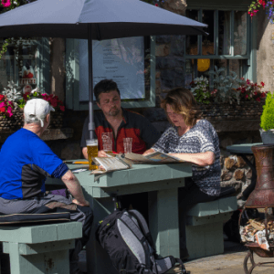
From Sedbergh Information Centre, 72 Main Street (1), walk through the car park and turn right onto Joss Lane. Follow this road as it curves round to the right, then becomes a very narrow lane. At the end of the tarmac go through the gate into the field and follow the track to the left of the buildings to a small gate in the top right corner (2).
Go through the gate then up a narrow path which leads through a second gate into an open area beside the stream which is known as Settlebeck Gill. This is a great place for kids and dogs to play in the water. Continue up the left-hand side of the gill until a further gate is reached which leads onto the open fell (3). Just beyond the fell gate there is a stone bench for a well earned rest where you can enjoy magnificent views down to Sedbergh and to the hills to the south which include Whernside, Crag Hill and Calf Top.
From here a shorter walk follows the fell wall westwards all the way to Lockbank Farm (point 8) where you can descend back to the town.
To continue upwards follow the steep left sloping ramp behind the benches. At the top of the ramp turn right on the obvious path which crosses a rocky area then rises more gently across the slopes above Settlebeck Gill until the path reaches a stream (4). Cross the stream and continue up the centre of the valley through a boggy area then follow the steepening path. About half way up the slope there is a junction where another path forks diagonally left (5). Take this path left, crossing an obvious bridleway, until you reach the broad ridge. Then turn left to walk along to Winder summit with its trig point and orientation cairn (6).
There are a number of ways to return to town but perhaps the finest is to continue straight on past the cairns to drop down the broad west ridge of Winder. As you get down towards the fell wall the path swings to the left round the ridge and shortly afterward swings right again (7). At this point left turn on a path which heads in a southerly direction across the slope, crossing a couple of streams. After rounding the base of the hill Sedbergh comes into view. The track drops down following the fell wall to a gate above Lockbank farm (8).
Walk down through the farmyard (if you have to open any gates please close them behind you) to a tarmac lane which leads Howgill Lane. Turn left to return to the town centre.
The ascent of The Calf 676m

Map produced from OpenStreetMap.org
Distance: round trip 13km (8 miles), 800m (2600 ft) of ascent
Time: 4 – 5hrs
The Calf is the highest point in the Howgill Fells at 676m (2217ft). It is an excellent walk on mainly good tracks but it is a mountain route and should be treated as such (see map and information on back page)
Begin by following the Winder route to point (5) but instead of turning left towards Winder continue straight upwards to reach the shoulder then turn right on the large bridleway. This ancient route traverses the shoulder of Arant Haw on its way north. Continue until you reach a marker post (A). Here you have a choice:
Either continue on the bridleway for about 1km until it eventually reaches the shoulder of Arant Haw and another marker post (B).
Alternatively if you want to take in the summit of Arant Haw then turn left at the marker post and go straight up the long, steep slope to the summit, where there is a small cairn. After the summit head north east on a small path along the ridge until you rejoin the bridleway near its highest point (marker post) (B).
After passing over the shoulder of Arant Haw the bridleway drops down to an area known as Rowantree Grains. From here climb steeply up the stony track beside a fence to reach the next summit, Calders (C). From Calders continue north on the broad undulating track for just over 1km to the white trig point at the summit of The Calf (D).
From the summit there are fine views over the northern Howgills to the peaks of the Pennines including the highest – Cross Fell, and Great Dunn Fell with its distinctive “golf ball” tracking station. To the west lies the long chain of the Lakeland fells.
Return to the shoulder between Arant Haw and Winder and descend to the town from here, or continue along the ridge to join the Winder route.