

Map reproduced from OpenStreetMap.org
Click here to download a pdf of this walk
Distance: 19.0 km (11.75 miles) Ascent: 450m (1500ft)
Time: 4 – 5 hours
Moderate to tough with section of open fell. Extensive views. Not suitable for prams, buggies or wheelchairs. Boots or trail shoes needed. Muddy after rainfall.
Starting from Sedbergh Information Centre, 72 Main Street (1), go down the small alley (The Folly) immediately opposite and to the right of Rycroft’s Hardware Shop. On meeting the main road at the bottom turn left and cross the road using the zebra crossing.
Where the lane swings left go through a kissing gate into the field and walk straight uphill. Cross the lane (Winder Drive) between two more kissing gates and to the top of the hill (2). On cresting the hill walk downhill, swinging leftwards to a small gate, across the field to another gate, then alongside a water channel. After the next gate turn left to follow the river Rawthey until eventually arriving at New Bridge.
Cross over the river at New Bridge and follow the road away from Sedbergh, at first on pavement then carefully on the roadside (please walk facing the oncoming traffic), for 300 metres then take the first right turn (Lane Ends) (3). After a further 200 metres the road forks. Here keep left and climb Frostrow Lane for 800 metres passing between various cottages and farm buildings, and ignoring all signposts to left or right.
At the end of the tarmac (4) continue on a stony track to reach a ladder style over a wall. Cross the stile and continue out onto the moors, following the bridleway for the next 2km. To begin with follow the wall and stream. At a cairn fork left and walk steeply uphill. Continue in the same direction keeping a wall and a barn over to your left. Head slightly right to cross a boggy area and then follow the distinct track up the valley with Holebeck Gill on your left. The track swings steeply up the slope, and can be very boggy in places.
Eventually you will come to a corner of a wall near the summit ridge of Long Moor. Continue along the track with the wall on your right until you reach a fingerpost with a gated stile on your right (5). Cross over the style and now continue downhill, with Dent appearing in the distance, again keeping the wall on your right.
This track will become walled-in on both sides and passes through a series of gates. Follow the track for 1 km until eventually passing between farm buildings at Lunds. Here dogleg left and right to then follow the tarmac lane down to join the Sedbergh to Dent road. Turn left along the road for a few paces and cross over the River Dee at Barth Bridge (6).
For a shorter walk take the stile on the right just after the bridge. Follow the Dales Way through fields by the river to emerge on the minor road part way between Gawthrop and Brackensgill Bridge. Blue route on map
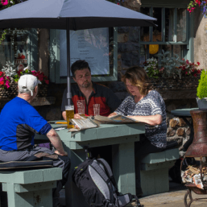
Continuing the main route take an opening on your left just after the bridge. Follow the path across fields, through gates and over stiles until you again meet the main road. Turn left along the road for a few paces until re-joining the path to follow the river Dee upstream. At the road turn right and walk up into Dent (7) where you can explore the church, the Heritage Centre or take advantage of the shops, tearooms and pubs.
On leaving Dent take the road towards Sedbergh, past the Information Centre and then look out for a fingerpost on your left by a sign for Dales Trails (8). Follow the footpath round to the right into a campsite then follow the narrow path beside the wall. After crossing a stile proceed half-left uphill across the field to pass through a farm gate and between farm buildings. Continue in the same direction through fields following the signs to Gawthrop.
Approaching the hamlet hug the lefthand side of the field and pass between the farm buildings, through a gate, and swing right to meet the road at a T-junction in Gawthrop (9). Turn left then go straight on (signposted Millthrop & Sedbergh) You will now stay on this quiet lane for around 2km.
Shorter route joins in part way along this lane. (10)
Continue along the lane, ignoring a footbridge on your right at Ellers, until you walk between farm buildings. Here turn right to Brackensgill Bridge (Dales Way) (11).
Make your way across a plank bridge to the main bridge over the Dee. Proceed up the track to the road. Go slightly left then cross it to take the track opposite, heading uphill, signposted Millthrop.
After 150m take the left fork (12). Follow this bridleway for about 1km past a cottage on your right, across a field, through a wood, along an enclosed track, then along the right edge of another field to emerge once more on the moors. Follow the track ahead of you to the hamlet of Millthrop (13).
At the bottom of the track turn right then take the first left, walk down to the main road, turn right and cross the River Rawthey (care – narrow bridge).
Walk uphill for 250m, facing the oncoming traffic until, you see a small gated stile on the right immediately opposite the road sign for Sedbergh (14). Go through the gate and follow the path across the field. At the top of the hill, pass through a squeeze stile and on cresting the hill you will recognise the track from your outward journey.