The trail follows a route through the town centre, and through part of the Sedbergh School grounds. There is a separate walk leaflet (Walk 4) around the School. The walk takes about 1 hour.
Click here to download a pdf file of this walk
Introduction to Sedbergh (pronounced sed-bur)
Sedbergh is a small, stone built market town, originally in the West Riding of Yorkshire until 1973 when it became part of Cumbria. It remained in the Yorkshire Dales National Park. To add to the confusion it has a Lancashire postcode. The name Sedbergh is believed to derive from the Viking words for flat-topped hill.
The trail starts at Sedbergh Information Centre. This building was formerly known as the Manor House, later as Oakville. It was owned in the 19th century by the Watson family including Dawson Watson, solicitor, and his son the Victorian artist John Dawson Watson RWS RBA. It was later a tailor’s and supplied George Bernard Shaw with individual left and right foot socks, such as his mother had made him.
The narrow main street with its yards (or alley ways) is the oldest part of the town and is mostly in a Conservation Area.
Cross Main Street to The Folly. This cobbled yard is typical of what the yards along Main Street would have looked like in the past, with small cottages on both sides. Most of these yards have lost this appearance due to redevelopment and changes in use.
Return to Main Street and turn left (west). Opposite the public toilets is a house formerly known as The Terrace built by Henry Wilkinson, a former Headmaster of Sedbergh School, in 1831. It is said that he left a passageway, now closed with double doors, so the Town could still see through to the hills, but possibly it was just an entrance that horses could pull carriages into (porte-cochere). It is now part of one of the girls’ boarding Houses, Carus House.
Continue along Main Street. On the right (north) is the former United Reformed Church, now redeveloped into apartments. John Laing, founder of the famous construction company, was a frequent preacher there, and he built Hart House, one of the School boarding Houses. The author VS Pritchett often visited his grandfather, a minister there.
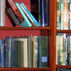
In front of the church is a former bus shelter, now a help-yourself book exchange. Where this stands was a block of houses known as Bun Row as one of the Town charities awarded loaves to the poor inhabitants living there. The houses were demolished soon after WWII. Besides being derelict they narrowed the street to the extent that a tank had got stuck there. The Town was reassured that the larger German tanks could not get down the street.
Further along Main Street turn left down Davis Yard under the lower storey of 55 Main Street past the small upturned cannon, said to have been abandoned by Bonnie Prince Charlie’s retreating soldiers. There are two more outside Cannon House, a former inn, now a private house on Back Lane. Davis Yard at one time had a tollgate across asking for a small charge (but only once a year!) to pass through.
Continue along Main Street. The next house is Marshall House, a typical 18th century Town House to which the gentry would retire in the winter from the country. It was formerly Swettenham House, became the School Bursary, and is now part of Lupton House, one of the School’s girls’ boarding Houses.
A little further on is a shop called the Sleepy Elephant (after Wainwright’s description of the Howgill Fells). This house dates back to the early 14th century and featured in the TV series The House Detectives. It has been occupied by a tax collector, a draper, a hosier and from about 1887 a chemist until a few years ago. Behind it is Weaver’s Yard where the first looms were set up in Sedbergh in the 18th century. The higher of the13 blocked windows in the side of the shop premises (blocked because of the window tax) would have provided light for the weavers. The large chimney breast at the back is said to have hidden Bonnie Prince Charlie when fleeing after Culloden – but so far as is known he never came anywhere near Cumbria at that time…
Return to Main Street. A little further along is the Green Door sweet shop. The first storey of which overhangs the pavement. This is the last remaining example of the type of housing typically built before the 16th century.
Continue along Main Street to its junction with Finkle Street. Here was the Market Place. Originally probably somewhat larger before the Rev. JH Evans, Headmaster of the School, built a reading room with a butter market below. Known locally as the Monkey House, the market is now enclosed with glass to form the Town Library. A market cross stood in the middle of the market, but was demolished – part of it stands in the garden of the local Quaker Meeting House at Brigflatts. On the wall of the Library is a plaque setting out the Town’s two market charters.
Two important roads over the Pennines and the roads to Kendal and Lancaster met at Sedbergh, and on the north of the Market Place was a coaching inn, now the Duo café. To the south is Finkle Street. A common street name in the north “Finkle” comes from the Norse word for a shopping street. This street used to have houses all down the west side. These were demolished in 1897 at the time of Victoria’s diamond Jubilee, and a drinking fountain installed.
The Parish Church of St Andrew is part Norman (particularly the entrance). On the north wall hang two tapestries embroidered by townsfolk depicting the Town. In the Parish Room a plaque commemorates local 18th century farmers who defied their landlord in a case resulting in the Enclosure Acts. The church has a ring of eight bells. In 1652 George Fox, founder of the Religious Society of Friends (Quakers), preached a sermon under a yew tree in the churchyard.
Walk up the alleyway between the old bank building and the Post Office. An alleyway to the right leads to King’s Square, an attractive group of restored cottages. Retrace your steps along the alley to arrive at Howgill Lane, just up from The Dalesman. Further up the lane, on the left, are two large white houses thought to be the oldest “shuttered concrete” houses in Cumbria. One housed boys from Sedbergh School before Winder House was built. It became a Masonic Hall, and is now flats. Beyond this Is the People’s Hall and gymnasium with the town playing field beyond.
Turn back down Howgill Lane. Where the Lane joins Main Street on the left is the Dalesman Inn. The building opposite the lane end is Evans House, bought by the School governors in 1799 as the Headmaster’s House. Over the years it acquired neighbouring buildings and is now a boys’ boarding house.
Cross the road and go down the narrow alleyway to the playing field beyond. The Sedbergh School main cricket pitch has been said by the BBC and several newspapers to be one of the most beautiful in the world. Once a year Lancashire County Cricket Club play a First Class match or matches there. Across the field are the School Bursary, the swimming baths, and two boys boarding Houses, Hart partly obscured by trees to the right (west) and Powell directly across. The School chapel is behind the Bursary. The main school teaching blocks are on the right behind the pavilion.
Turn left between the graveyard and cricket field to Loftus Hill. Across the main road is the School Library. This building is the oldest part of the School and was originally the School itself. It is thought to have been built on an older school building. The School was originally founded in 1525. The building had deteriorated badly and after the WWII Brendon Bracken, Churchill’s right hand man and Chairman of the Governors, restored it as a tribute to Churchill, whose bust frowns down on the working pupils.
Turn right (south) and walk up Loftus Hill. Opposite the School chapel turn left into Winder Drive. From the drive look north across the playing fields to where the hill Winder dominates the town. Below and immediately across the fields is Back Lane where two of the girls’ boarding houses, Lupton (mock Tudor) and Carus (with the modern arcaded building) can be seen. From here it is also possible to make out the outline of some of the former burgage plots (a town rental property, owned by a king or lord) running down from the houses on Main Street to Back Lane.
To the east are open fields leading up to a small hill, partly in the trees, where there are the remains of a motte and bailey castle, which has a deserted cold war listening post hidden under the bailey.
Behind you (south) is Robertson House, the third girls’ House with Fives Courts in front and the former Rectory behind. At the end of Winder Drive is Winder House (boys).
At the entrance to Winder House turn downhill through a metal kissing gate. To the right across can be seen the Old Vicarage with its 17th century round chimneys. Continue to Back Lane and its junction with Main Street. Across the road to the right is the behind the bookshop is a small car park where the police station used to be.
Cross the road into Main Street and walk back to the Information Centre. On the left opposite New Street are houses that used to be the Town Workhouse. Up New Street is the Methodist church which replaced an octagonal chapel.


