

Map reproduced from OpenStreetMap.org
Click here to download a pdf of this walk
Distance: 3.4 km (2.2 miles) Time: 60 – 80 minutes
An interesting short walk with fine views of Sedbergh.
Moderate walking, some uphill at the start. Not suitable for prams, buggies or wheelchairs. Boots or trail shoes needed. Can be muddy after rainfall.
Starting from Sedbergh Information Centre, 72 Main Street (1), turn right along Main Street and walk west passing the public toilets and the shops until turning right immediately before the Post Office, signposted “Public Footpath” (2)
Proceed through the narrow alley pausing to admire the cluster of small stone-built cottages around Kings Yard. At the end of the alleyway, cross over the road and proceed in the same direction down another fenced-in path. At the end of this pathway turn left onto Fairholme. Within 100m you will reach a T-Junction with Sedbergh People’s Hall facing you (3). Turn right here and proceed up Howgill Lane, following the path which can be accessed through a wooden gate beside the children’s playground.
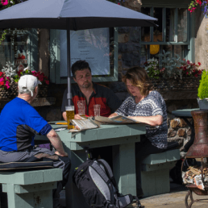
Proceed uphill with houses on your left and past a vintage red telephone box. A couple of hundred metres further on, just as the houses start to thin out, look for a well-marked lane on the right, signposted ‘permissive path to the fell’ (4). The path brings you up to Lockbank Farm where there are often cows, sheep, pigs, chickens, ducks and geese to be seen. On reaching the farm you may wish to make a 30 yard diversion to your left to visit Howgill Fellside Ice Cream. If they are not open call 07985 654832 and the farmer will soon appear. Cross the yard, up the track and through two metal gates to arrive at the open fell (5)
Once through the gate turn right and start a steady climb keeping the fell wall on your right.
You will now follow a rough track for over half a mile with good views down over Sedbergh and the surrounding area. You can clearly see the town in the foreground and the buildings of Sedbergh School beyond the town to the south. A bit further along, near the telecommunications mast, you can now see the Old Castle Mound; the Parish Church in the centre of the town; the modern Primary School buildings with triangular glazed roofing; and Garsdale to the east.
Continue until you reach a stone bench built into the hillside above the path (6). A steep path on the left leads up Winder and the deep gully of Settlebeck Gill lies ahead. Turn right through a kissing gate and down a set of steps. You will descend through a small wooded area high above the gill. At the bottom of the wood the main path continues straight, through a small gate (this provides a shortcut back to Sedbergh if the exertion has proved too much already or if the heavens have opened!).
To continue the walk, bear diagonally left downhill towards the beck, signposted to Thorns Lane, and make your way across the beck (7) which can be difficult to cross after heavy rain. On the far side, turn right and follow the path down through Jubilee Wood (the signpost directs you to Castle Haw) until you come to a gate. Go through the gate. Castle Haw Farm, one of the oldest houses in the town, is to your right (if necessary, you can go straight on here as this track provides another shortcut back into Sedbergh).
To continue the walk, turn left and within a few paces you will come to a Howgills Bunk Barn on your left (8). With your back to the building pass through the tiny gate in the stone wall (note the apple tree beside the gate which was a gift from our twin town in Slovenia). A path takes you down, over a stile and into a wood. Follow the clear path downhill over a small stream and a stile until you join a wider track which bends left as it nears some houses.
Go through a metal kissing gate and turn right onto an unmade road (9). Follow this road downhill for 300 metres. Notice the castle-like house on your left and another with the wonderful name of ‘Owertbrig’, meaning ‘over the bridge’. A path on the right (10), almost opposite Owertbrig, takes you over a little bridge beside a paddock on your right (which sometimes has Shetland ponies in it) and skirts round the back of some flats. As you make your way along here, notice a huge lime tree ahead and, to your right, the Castle Mound again
Go through a narrow wooden gate into a field and follow the track until you come to the A684 at the eastern end of the town (11). Turn right along the A684 and after a few paces you will pass Westwood Books, previously Sedbergh Cinema building. Soon bear half right and you will find yourself back in Main Street.